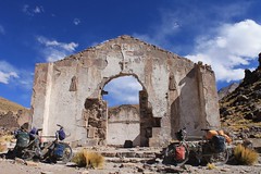
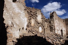
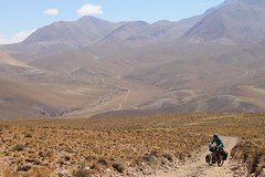
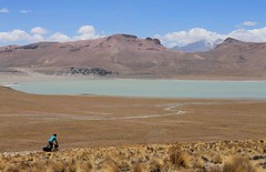
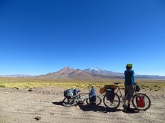
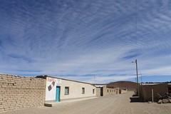
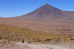
After leaving the main Uyuni – Tupiza road, pass through San Vicente – the unlikely location where Butch Cassidy and the Sundance Kid met their end. This is the first of a number of small, sad villages en route to the paving in Chile. In one of these, Quetena, it’s possible to detour to Uturuncu, to climb one of the highest roads in the world.
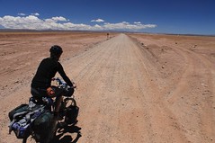
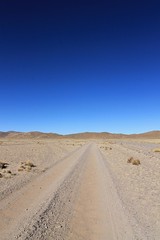
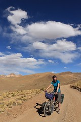
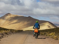
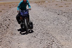
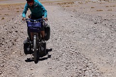
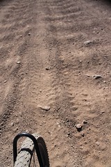
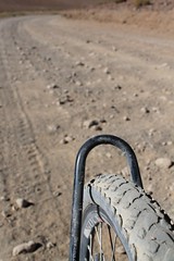
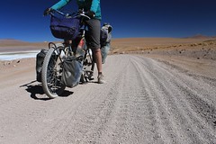
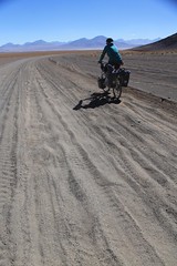
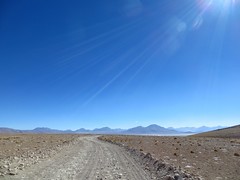
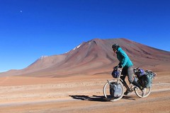
The surface on many stretches is corrugated and sandy, and climbs to Abra Laguna Morijon and Abra Laguna Hedionda have some very steep kilometres, making this a more challenging route than the ride via Laguna Colorada, Villamar and Alota. From what we’ve heard, the Classic Route is sandier than this one.
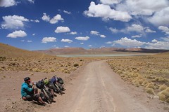
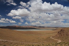
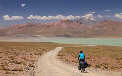
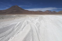
From San Vicente to the Salar de Chalviri you’ll only meet a handful of jeeps a day (which are doing tours of the Sud Lipez out of Tupiza rather than Uyuni), however this soon changes when you reach the thermals at Polques. From here to Laguna Verde and Chile the riding becomes a bit easier, but there is loads of traffic. Expect to be coated in dust at regular intervals.
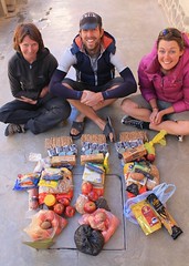
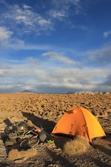
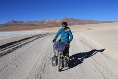
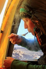
Basic supplies can be bought in a number of villages, but if the thought of surviving on pasta, biscuits and crackers doesn’t appeal, then bring your food from Uyuni or San Pedro. Water is reasonably scarce and needs to be carried for some sections, but isn’t a particular problem – we’ve noted where it can be found in the route description.


| Dist (km) | Altitude (m) | Description |
|---|---|---|
| 0 | 3670 | Uyuni. Boring tourist town which is near a nice salar. Leave heading south on road to Tupiza. |
| 33.5 | 3690 | Noel Mariaca. Small, near abandoned village. Water may be available. |
| 56.7 | 3810 | Sullchi. Small village. Water, shop, restaurant. |
| 58.1 | 3810 | R to San Vicente. L continues to Tupiza. |
| 74.7 | 3920 | L. R goes to Cocani. Very flat, some corrugations and sand. |
| 84.1 | 4020 | L. R goes to Agua de Castilla. |
| 85.1 | 3990 | R. L goes to Animas-Porco. |
| 113.1 | 4670 | Abra San Vicente. |
| 119.2 | 4580 | R at barrier, guarded by mine workers. |
| 120 | 4510 | San Vicente. Basic shops, water. |
| 120.1 | 4510 | L – signed ‘Tupiza’. |
| 121 | 4550 | Barrier – leave mine/village. |
| 132.6 | 4390 | L. R goes to Cocani. |
| 133.8 | 4360 | R. L is the main road to Tupiza (junction is on a LH bend). |
| 135.7 | 4250 | R – signed San Pablo. L goes to Candelaria. |
| 146.4 | 4200 | L. |
| 149.3 | 4230 | R. |
| 150.1 | 4250 | Straight. Road joins from L. |
| 154.9 | 4160 | A couple of houses with some dogs. May be water. |
| 167.3 | 4570 | Abra Boroanza. |
| 174 | 4420 | Straight. L goes to Viluyo. |
| 175.3 | 4330 | Low point, huts. Water. |
| 177.6 | 4460 | Straight. L goes to Mina Sta Isabel. |
| 188.4 | 4610 | Straight. |
| 193.1 | 4750 | Abra San Pablo. |
| 195.7 | 4610 | Small stream. |
| 202.3 | 4390 | Cross stream. |
| 208.6 | 4250 | L, over bridge in San Pablo. |
| 208.9 | 4250 | Plaza de Armas, San Pablo. Shops, water, accommodation. |
| 211 | 4210 | Straight, then straight again soon after. |
| 211.6 | 4210 | L, on main ‘road’. |
| 214.7 | 4180 | R. |
| 217.2 | 4150 | Straight. |
| 219.8 | 4170 | Straight. L goes to Exp. Lipez. |
| 228.6 | 4030 | Straight. Road joins from R. |
| 231.8 | 4010 | Cross stream. Drinkable. |
| 232.2 | 4020 | L. |
| 241.8 | 4140 | Straight/L. |
| 246.3 | 4210 | San Antonio. Basic shops, accommodation, water. |
| 247.1 | 4220 | L. Lots of streams, houses around. |
| 253.3 | 4410 | L/straight. |
| 253.7 | 4430 | Cross stream. |
| 257 | 4570 | Cross stream. |
| 259.4 | 4720 | Abra San Antonio. |
| 260 | 4660 | San Antonio Viejo. Ghost town. Water. |
| 262.9 | 4560 | Water. |
| 267.2 | 4450 | Cross river, and low point. |
| 273.2 | 4800 | Abra Puca Loma. |
| 277.3 | 4590 | Cross stream. |
| 278.3 | 4540 | Cross stream. |
| 281.3 | 4440 | Cross stream, then start steep climb. |
| 285.3 | 4740 | Cross stream. |
| 288.2 | 4901 | Abra Laguna Morijon. |
| 294.8 | 4580 | Cross stream, by Laguna Morijon. Low point. |
| 296.9 | 4600 | Straight. Road joins from R. |
| 299.7 | 4620 | Spring, to L of road. |
| 301.1 | 4750 | High point. |
| 307.2 | 4640 | Cross stream. |
| 313.5 | 4430 | Cross stream. |
| 321.2 | 4250 | Straight. L to Laguna Celeste. |
| 324.7 | 4210 | Sol de Mañana, Puesto de Control. Pay Bs150 to enter Eduardo Avaroa Reserve. |
| 328.4 | 4330 | High point. |
| 334.3 | 4140 | Wade river. |
| 339.1 | 4150 | Quetena Chico. Ok shops, accommodation. Turn L for Uturuncu. Continue straight for Quetena Grande. |
| 343.8 | 4170 | Quetena Grande. Shop, water. |
| 358.6 | 4270 | Wade river. |
| 364.3 | 4730 | Abra Laguna Hedionda. Steep top 3 km! |
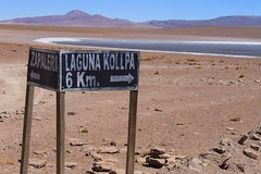
| 371.2 | 4580 | R to Laguna Kollpa. L goes to tri border point at Zapaleri. |
| 378.1 | 4540 | Mine and houses by Laguna Kollpa. Water in pozo by salar’s shore, just to S of longest building. |
| 384.6 | 4490 | R to Aguas Termales (Polques). |
| 394.9 | 4390 | Abandoned houses. No water. |
| 399.7 | 4400 | Straight. |
| 405.8 | 4430 | Hit main Laguna Route. Jeep, ugh. Go L for Polques, R for Paso Sol de Mañana. |
| 409.1 | 4400 | Polques. Thermals and snacks. Maybe meals. Water. |
| 428.7 | 4730 | Paso del Condor. |
| 441.8 | 4370 | R heads off to Mirador and Lag Verde. Stayed L on main road. |
| 442.5 | 4360 | Stay L on main road. |
| 451.2 | 4370 | Puesto de Control, Laguna Blanca. |
| 457.9 | 4480 | Bolivian immigration and border. |
| 463.2 | 4660 | Hit paving. Go R for San Pedro. |
| 508 | 2430 | San Pedro de Atacama. Tourist central. |
| Details | |
| Distance (of which paved) | 508km (45km) |
| Time taken | 8 days |
| Amount climbed | 7500m |
| Traffic | Plenty from Uyuni to San Vicente. 10-20 vehicles a day from San Vicente to Polques. Loads from Polques to San Pedro de Atacama. |
| Best time to cycle | April – October |
| When we cycled | November 2013 |
| Difficulty | 4 |
| How much we had to push on this route | <0.1km |
Error thrown
Call to undefined function ereg_replace()