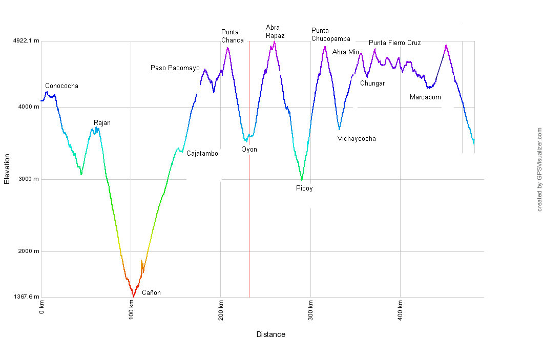
Conococha – Cajatambo – Oyon – Parquin – Chungar – Marcapomacocha – Casapalca
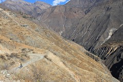
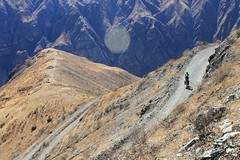
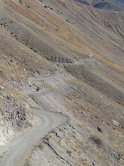
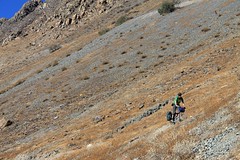
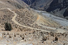
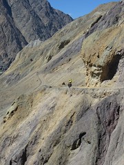
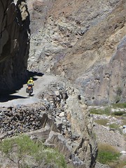
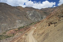
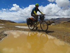
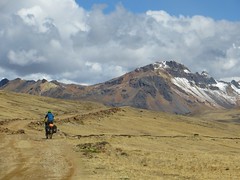
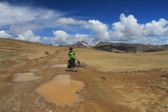
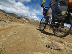
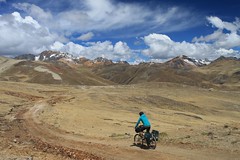
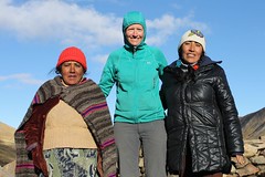
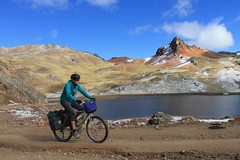
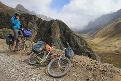
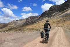
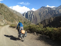
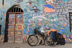
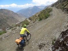
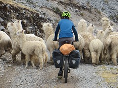
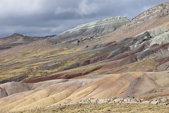
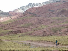
This fantastic route is an excellent choice for getting from the Cordillera Blanca to the Carretera Central (the main road from Lima to the mountains) on quiet unpaved roads. The route passes through villages, so it’s never necessary to carry more than a couple of days of food. There is also plenty of water, so you don’t need to carry much of that either, but watch out not to take it from downstream of a mine.
There is almost no traffic on this entire route, apart from a few trucks near Alpamarca and the traffic madness of the Carretera Central.
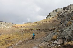
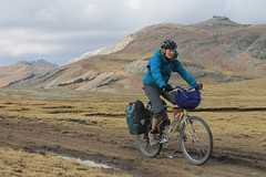
As with all routes in the Peruvian Andes, we can’t stress highly enough how important it is to go light – there are many high passes to cross and many thousands of metres to climb. Here is a list of kit we took for the ride – around 15kg each.
Check out our blog post for this route on our Pikes on Bikes site, and for a slightly damper version of events, here are Cass and Kurt’s impressions of the route – they were a fortnight behind us.


| Total Km | Altitude (m) | Description |
|---|---|---|
| 0 | 4110 | Junction in Conococha where paved road leads off to Chiquian. Take the paved road towards Lima. |
| 2.3 | 4100 | Go L onto dirt road. Signed Ocros. |
| 6.6 | 4230 | Junction and pass (Yantahuain). Go L to Ticllos (R is for Ocros). |
| 16.4 | 4150 | Junction. Go straight. L goes to Roca. |
| 26.7 | 3700 | Ticllos. Village with shops. |
| 36.9 | 3400 | Corpanqui. Village with shops. |
| 42.4 | 3190 | Ignore junctions off L to Llaclla. There’s no way from Llaclla to Oyon by road – the old road along the valley floor has been destroyed. |
| 46.3 | 3080 | Junction by Carhuajara (village below road). Go R/up. |
| 51.4 | 3380 | Village. |
| 55.8 | 3570 | Junction by Cajamarquilla. L goes to this village – go R on a track that is briefly unmotorable. |
| 56.6 | 3620 | Go R on motorable road. |
| 63.3 | 3740 | Junction. Go L to Rajan. R is for Ocros. |
| 67.6 | 3640 | Rajan. Village with shops and possible to find accommodation. Huayhuash views. |
| 74.6 | 3090 | Llipa Viejo. No facilities. |
| 80.1 | 2780 | Llipa. Village with shops, possible accommodation. Get water – there’s none except in the main river until at least an hour’s climbing from Cañon. |
| 98.7 | 1630 | Cross bridge over main river. |
| 106.8 | 1390 | Cross bridge over Cajatambo river. |
| 107.1 | 1390 | L on ‘main’ road to Cajatambo. |
| 115.5 | 1750 | Water from side waterfall (if running). |
| 117.5 | 1800 | Tumac. 2 houses, and a very basic shop. Also a junction – L goes to Mangas. Go R. |
| 125.4 | 2240 | Baños Termales de Uñoc. Food, and maybe camping possible. |
| 130.3 | 2480 | Junction – go straight for Cajatambo. Palpas is R. |
| 134.9 | 2690 | Yocchi. Village with shops. |
| 155.5 | 3450 | High point before small descent to Cajatambo. |
| 159.8 | 3400 | Cajatambo. Accommodation, restaurants, shops. No internet or ATM. Start climbing again on road to Oyon. |
| 168.5 | 3880 | Junction – go R for Oyon. |
| 170 | 3960 | Junction – go R for Oyon. L goes to Huayllapa on the Huayhuash Circuit. Stick to main track to the pass. |
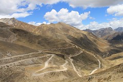
| 185.3 | 4540 | Paso Pacomayo. |
| 191.6 | 4360 | Cross bridge at low point. |
| 193 | 4380 | Go L at junction in Pacomayo (R is a far better road, but this leads to Gorgor, not Oyon). Pacomayo is just a few houses, no facilities. |
| 196.4 | 4450 | Junction – go L to Mina Chanca and Oyon. R is to Mallay. Pass Karina’s bodega (basic shop, sometimes open) before the mine. |
| 198.7 | 4540 | Junction by Mina Chanca. Go L, then immediately R at fork. |
| 203.8 | 4850 | Punta Chanca. |
| 217.1 | 3960 | Meet other road on a hairpin. Go R. (L goes north, to the east of the Cordillera Huayhuash – ask locals about the current security situation in that area if you are considering going that way.) |
| 221.8 | 3650 | Hit larger road in a village. Go R to Oyon. L is to Raura. |
| 225.7 | 3540 | Junction. L to Oyon. R is for Lima. |
| 228.5 | 3630 | Oyon, Plaza de Armas. Shops, accommodation, restaurants, internet. ATM didn’t work when we were there. Leave town on road to Cerro de Pasco. |
| 230.2 | 3640 | L on paving which soon ends. |
| 233.1 | 3640 | R – signed Mina Iscaycruz – leaving the main road for a mine road to Rapaz. Mine traffic. |
| 236.7 | 3870 | Stay R (L to mine). No longer any mine traffic after here. |
| 238.5 | 4020 | Straight. |
| 244.1 | 4420 | Straight (L is a shortcut). |
| 245.6 | 4490 | Straight (shortcut rejoins). |
| 245.9 | 4520 | Junction. We went L and the distances to km261.2 reflect this. See comments below though – it now appears you have to go R, signed ‘Rapaz’, over a 4990m pass, and join the description again at km261.2 below. |
| 247.5 | 4490 | Cross bridge. |
| 252.8 | 4870 | High point. Slight descent. |
| 256.9 | 4940 | Abra Rapaz. |
| 261.2 | 4640 | L. Signed Rapaz. |
| 271.3 | 4020 | Jn in Rapaz (shops). Go straight. R goes to the plaza, with a nice old church. Possible to buy nice woven goods – ask around. Also the largest quipu in Peru is apparently here. |
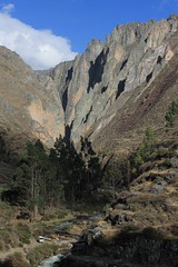
| 280.9 | 3320 | Entrance to the canyon. |
| 282.6 | 3260 | Huancahuasi/Picoy baths. Possible amping. |
| 283.6 | 3230 | Huancahuasi. Shop, accommodation, restaurants. |
| 287.1 | 3000 | Picoy. Go L to Parquin. Going R descends to the Oyon – Huacho (on the coast) road. |
| 294.9 | 3550 | Parquin (well stocked shops). Stay straight – R goes to Jucul. |
| 305.5 | 4440 | First water since Parquin. |
| 307.4 | 4460 | L at junction, just after crossing river. |
| 313 | 4860 | Punta Chucopampa. |
| 321.5 | 4360 | R at jn. |
| 329.6 | 3710 | L on main road to Cerro de Pasco over Abra Antajirca. R goes to Vichaycocha (a few km away downhill). |
| 346.9 | 4560 | R, off main road. Signed Minas de Chungar. |
| 352.6 | 4760 | Abra Mio. |
| 359.1 | 4460 | Chungar. A few houses by the Lago Chungar. |
| 359.3 | 4450 | Go L, under the dam. |
| 364.4 | 4650 | R. |
| 366.6 | 4760 | L. |
| 368 | 4820 | Punta Fierro Cruz. |
| 368.2 | Straight/R. | |
| 372.2 | 4640 | L. |
| 373.4 | 4660 | Straight. |
| 373.7 | 4660 | R. Follow water channel after a while. Flat! |
| 379.9 | 4640 | R on main Abra La Viuda-Huayllay road (L goes to Bosque de Piedras 43km away, apparently). |
| 382.4 | 4710 | High point and junction. Go straight. L to Chalet/Mina Alpamarca. |
| 384.4 | 4670 | L. R goes to Mina Alpamarca. |
| 389.2 | 4560 | Go L, to Canta. R is to Mina Santander. |
| 390.9 | 4560 | R. |
| 394.9 | 4710 | Abra Alpamarca. |
| 395.8 | 4680 | L to Yantac. R is main route to Canta and Abra la Viuda. |
| 397.2 | 4560 | L. |
| 398.2 | 4570 | Straight. |
| 399.6 | 4520 | R. |
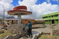
| 405.3 | 4650 | Yantac. Hat statue, shops, restaurant. |
| 407.5 | 4640 | Straight. |
| 410.8 | 4550 | L. |
| 419.8 | 4440 | Marcapomacocha. Accommodation, restaurants, shops. |
| 425.4 | 4280 | Straight, for Casapalca. L goes to Corpacancha. (If you’re headed to La Oroya and want to avoid the Carretera Central, see route update below.) |
| 430.6 | 4300 | Straight. L goes to Sungrar. |
| 433.2 | 4340 | L/Straight. R to Obelisco which marks some battle. |
| 443.2 | 4710 | Go straight. R is for Milloc and Huanza. |
| 447 | 4880 | Abra Antacassa. |
| 459.6 | 4340 | R on the Carretera Central. L goes to La Oroya. Be very careful – the traffic is heavy, the road narrow, and the driving appalling. |
| 462.9 | 4200 | Casapalca. A hole, which has accommodation, shops, restaurants. |
| 472.9 | 3700 | Chicla. There is a hotel before the village, by the main road (but no accommodation in the village). Shops and restaurants in the village. |
| Details | |
| Distance (of which paved) | 473km (16km) |
| Time taken | 8 days |
| Amount climbed | 11,200m |
| Traffic | Very little, except for the few kms on the Carretera Central which is very busy. |
| Best time to cycle | May – September |
| When we cycled | Early October 2013. |
| Difficulty | 4 |
| How much we had to push on this route | Not at all |
Error thrown
Call to undefined function ereg_replace()