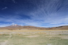
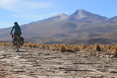
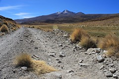
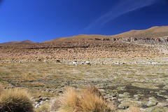
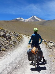
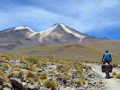
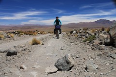
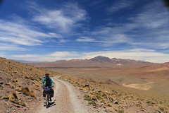
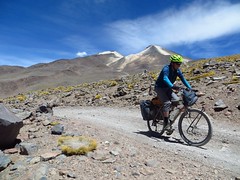
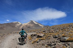
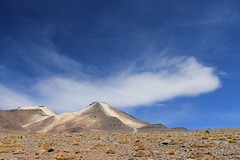
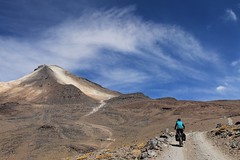
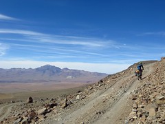
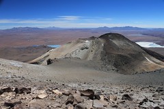
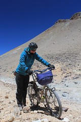
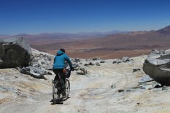
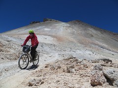
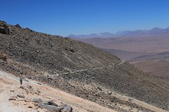
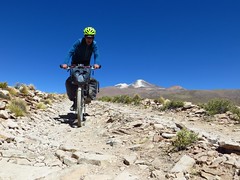
The mine track up Uturuncu is one of the highest roads ever built. These days the mine is closed, but it’s still possible to bike up to the col at 5760m between the mountain’s two peaks. Given the right acclimatization and the right bike, all but one short 50m section of the road to the col is cycleable; however, near Quetena there are some sandy stretches and above 5000m much of the road is steep, so most people will find themselves pushing large sections.
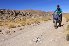


The col is 30km by road from Quetena Chico, a small village with some basic shops and accommodation options. Bring all your food and water from here. If you’re very fit, very acclimatized, go unloaded and leave early, it’s possible to do this as a strenuous day trip from the village.
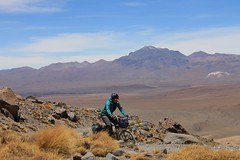
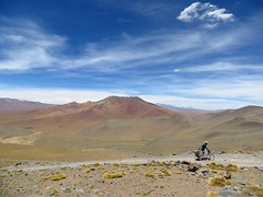
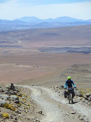
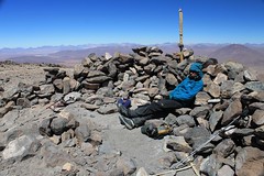
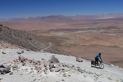
From the col, it was less than an hour of walking on a decent path for us to reach the mountain’s 6008m summit, thus rendering it one of the easiest 6000ers in the world.
| Dist (km) | Altitude (m) | Description |
|---|---|---|
| 0 | 4150 | Quetena Chico, Plaza de Armas. Take the track heading at the volcano. |
| 8.8 | 4310 | R. |
| 9.6 | 4280 | L. Water by mine. Not sure I’d drink it. |
| 10.5 | 4300 | Go R (L is slightly more direct, but very sandy). |
| ~13.1 | 4350 | Two routes rejoin. |
| 24.5 | 5240 | R. |
| 27.5 | 5550 | Flat area, possible to camp. |
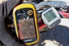
| 30.5 | 5760 | Col between peaks. It’s possible to cycle a few metres higher up to N/L. |
| 61 | 4150 | Quetena. |
| Details | |
| Distance (of which paved) | 61km return (0km) |
| Time taken | 2 days (return, including climbing the peak) |
| Amount climbed | 1750m |
| Traffic | 2 vehicles in 2 days |
| Best time to cycle | April – October |
| When we cycled | November 2013 |
| Difficulty | 5 |
| How much we had to push on this route | 1km (half on the sandy sections near Quetena, half on the steep sections high up) |


hey guys,
as we wanted to ride up to the col in two days and didn’t wany to camp too high so we thought this information might be usefull to others:
good campspots @ km 15 (rock formations, altitude ~4’460m) with many options to hide stuff and go light to the top from there. we left town after lunch for an easy ride to km 15, spent the night there, left early & light (with tent & sleepingbags well hidden in the rocks) for the remaining 15.5 km to the col the following morning and were back in town that afternoon.
if you want to go higher the first day: there’s a few spots to pitch a tent between km 15 and km 24, but not many options to stow stuff.
hope that helps
robin & daina
I accidentally took a wrong turn when returning to QC, going straight at km 8,8 instead of left.
This is a detour on a very bad track, but has some great views showing how the rivers have carved themselves into the plateau.
This track rejoins the main route again 2 km outside of QC, but would be extremely difficult to spot coming from Quetena Chico.
I rode up Uturuncu from Quetena Chico in late-May 2018. It was a very difficult day, even for me who has fitness and strength in the upper end. I was moving almost the whole time, and it still took 7hrs to ascend (4.4km/h) and 3:15hrs to descend (9.5km/h).
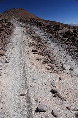
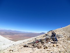
The track is one of the rockiest I’ve experienced in Bolivia so far. Think loose rocks a few times larger than your fists. The rock/sand combo made cycling really taxing because of the lack of traction!
I was using a lot of energy just trying to maintain my balance for the last 7km on the steep and loose surface, so I ended up pushing my bike a fair bit to the cycling high point. Not sure if the surface is worse than previous years, but you’d want some fat mountain bike tyres with low pressures, plus a really small gear ratio to get to the top without pushing.
It was surprisingly still and warm up the top. I bought heaps of winter clothing with me but ended up wearing what I would usually wear between 4000-5000m.
The landscape up the top is otherworldly. If you decide against riding up, I recommend asking around at Quetena Chico for a ride up in a tourist 4×4 to experience Uturuncu. From what I’ve heard, there’s at least one ride up there every day. The views from 5800-6000m are phenomenal!
Would I do it again? Hell yeah. Here’s a video from my experience: https://youtu.be/bdQ0uBlNUbk