The Argentine Gendarmeria and Chilean Difrol websites both state it is possible to cross the pass, and we found this to be true in practice. Exiting Chile, we obtained exit stamps in San Pedro (though we are aware of at least one cyclist who has since obtained an exit stamp at the border) and Argentine entry stamps at the border.
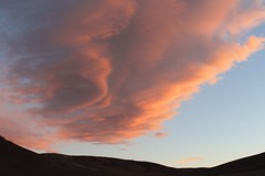
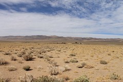
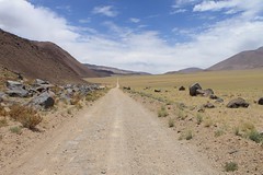
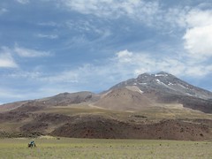
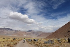
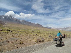
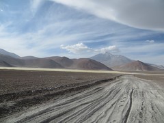
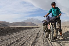
The bad surface, a lack of water sources, zero traffic and the heat in the desert on the Chilean side make this the most challenging of the six Chile-Argentina 4000m+ crossing options, despite it being the lowest. The Chilean scenery is dull from San Pedro to Monturaqui, but after this it is very beautiful, classic Puna as you cross a wild part of Salta province.
It will take most people at least five days between Peine, the last village on the Chilean side, and Tolar Grande, the first village on the Argentina side. Carrying provisions for this amount of time, added to the fact you have to carry a lot of water makes for a heavy bike.
We’ve only cycled the section from San Pedro to Paso Socompa. Thanks to Reginaldo Rohden for providing us with information and a GPX file for the whole route from San Pedro to Salar de Pocitos.


Reginaldo’s photos:


| Dist (km) | Altitude (m) | Information |
|---|---|---|
| 0 | 2430 | San Pedro de Atacama. Take paved road towards Paso Sico. |
| 37.5 | 2500 | Toconao. Shops, accommodation. |
| 71.3 | 2550 | R to Peine, onto dirt road. |
| 78.9 | 2320 | L to Peine/Antofagasta. |
| 86.6 | 2320 | Straight. |
| 101 | 2360 | Straight. R goes to Antofagasta. |
| 101.9 | 2360 | R. L is for short detour to Peine (basic shops, water). Stock up on water – nothing reliable after this until the border. |
| ~115 | 2370 | R, in Tilomonte (some trees, slightly salty stream, but not an inhabited place). |
| 138.4 | 2740 | L, under pylons. Hot, desert, no water. |
| 149.6 | 2880 | Pozo 4 (concrete tank with leaking pipes, so maybe can get water). |
| 155.6 | 2930 | Campamento, normally unoccupied. |
| 182.8 | 3370 | R. |
| 185.2 | 3480 | R. (L goes to Baical). A few mine vehicles for a while. |
| 186.7 | 3450 | L. |
| 192 | 3340 | L to Socompa on Carretera Internacional. Straight goes to Mina Escondida. End of traffic. |
| 203.6 | 3920 | High point, and junction (take L of the 3). |
| 210.9 | 3450 | L. |
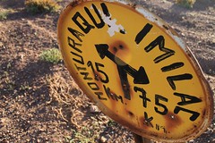
| 214.7 | 3440 | L. R to Estacion Monturaqui (uninhabited) and Llullaillaco (78km). |
| 221.8 | 3430 | R. L goes to Pozo Monturaqui. |
| 238 | 3880 | Portezuelo Socompa, Chilean Carabineros. |
| 239 | 3880 | Argentine Gendarmeria, immigration. Get water. |
| ~378 | 3530 | Tolar Grande. Basic shops, water, accommodation, fuel for multifuel stoves available. |
| ~402 | 4050 | Abra Navarro. |
| ~462 | 3670 | Salar de Pocitos. Shops. |
| San Pedro – Salar de Pocitos | Details |
| Distance (of which paved) | 462km (71km) |
| Time taken | 7 days |
| Amount climbed | ~5000m |
| Traffic | Some between San Pedro and Peine, a few vehicles an hour between Baical junction and the Carretera International. Zero elsewhere. |
| Best time to cycle | October – January, March – April |
| When we cycled | December 2013 |
| Difficulty | 5 |
| How much we had to push on this route | 1km |
Files for Reginaldo’s Route: San Pedro to Salar de Pocitos:
Error thrown
Call to undefined function ereg_replace()