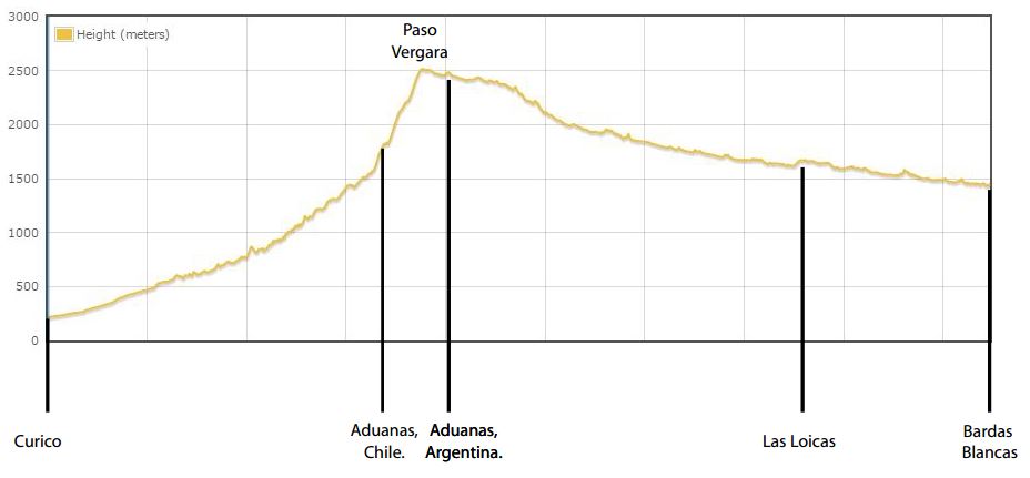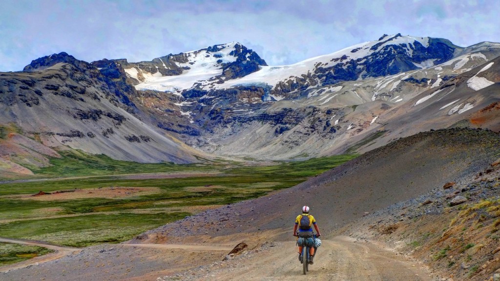
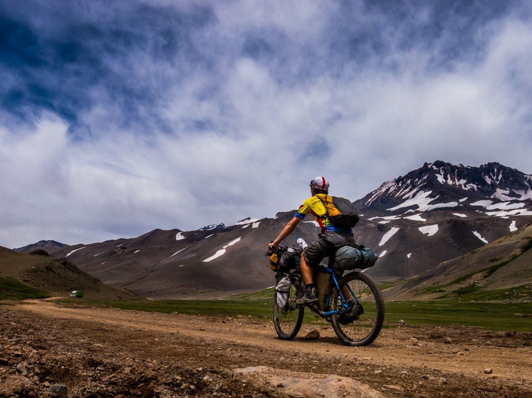
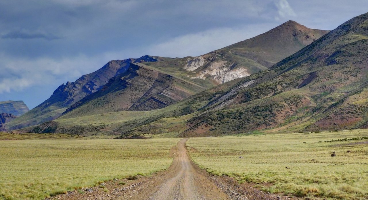
Of the many passes between central Chile and Argentina, Paso Vergara is a great option due to its low traffic volume and great scenery. The pass is not very high at 2500m, but the steep climb from Chilean customs is not one to take lightly. Though short, the road shoots up 700m in 9 kilometers. After completing the climb away from Chile, the road cuts through a large pampa that crosses many rivers and streams and passes by a few glaciers before finally connecting with the Rio Grande. From here, the road follows the river downstream until the junction with Argentina’s legendary Route 40 in Bardas Blancas.
Food can be bought both in Curico and in Bardas Blancas. Water is never a problem as small streams are abundant. There is no ATM in Bardas Blancas, so if coming from Chile, make sure to have enough Argentinean pesos to make it to Malargue (62km North of Bardas Blancas) or Chos Malal (255km South of Bardas Blancas).
There is also the option of making this route a loop by turning off in Las Loicas and crossing the Andes back into Chile via Paso Pehuenche towards Talca. We did not ride this road, but it appeared to be entirely paved and have much more traffic than Paso Vergara.
Accessing the start in Curico is best accomplished via bus or train from Santiago, both of which take around two hours and cost less than $8 (including bikes) in Jan 2015. Though we did not ask, this pass is presumably only open in the Summer. Check with authorities if you are wanting to attempt this pass early or late in the season.
*Thanks to Lee Vilinsky and Samuel Hochheimer for riding and compiling the information about this route.
All roads are visible on OpenStreetMaps. Since the main road is easy to follow, minor junctions/offshoots have not been listed in the Route Description.
| Distance | Elevation | Description |
| 0km | 200m | Curico (GPS01). Large town with accommodation, shops, restaurants, ATM. |
| 14km | Romeral. Town with accommodation, shops, restaurants. | |
| 36km | Pavement ends. | |
| 51km | Los Queñes. Town with a few small shops, one of which had fruit and veg. Last chance to stock up on food until Bardas Blancas in Argentina. | |
| 79km | Mine entrance. Go right for Paso Vergara, following the sign. End of truck traffic. | |
| 95km | 1800m | Chilean customs (GPS02). Water, free camping by the river, free “hot” springs (the water was barely warm). |
| 95.5km | Start of steep climb. Some of the sections of road can be very loose and sandy, so, combined with the grade, pushing may be necessary in some sections. | |
| 105km | 2,500m | Border (GPS03), end of steep climb. |
| 112km | 2,450m. | Argentinean customs (GPS04). Water. Glacial views. |
| 118km | There are supposed to be hot springs here, called Termas del Azufre, but we didn’t see them | |
| 166km | 1810m | Junction (GPS05), continue straight for Las Loicas. Road to left goes over another pass, directly to Malargue. |
| 177km | Road becomes sandy in some sections. | |
| 187km | 1690m | Estancia Los Mallines (GPS06). Camping and beer for sale. They might sell snacks, but we didn’t ask. |
| 213km | 1630m | Las Loicas (GPS07). Pavement begins. Small town with some shops, accommodation, municipal camping. Go L after the bridge. R goes toward Paso Pehuenche. |
| 223km | Construction. Pavement ends (briefly). | |
| 230km | Pavement begins again. | |
| 260km | 1480m | Junction with Route 40. L goes to Malargue (62km). We went R up the hill to Bardas Blancas. |
| 261km | 1500m | Bardas Blancas (GPS08). A few shops and a hosteria that allows you to camp for 20 pesos without hot shower or 40 pesos with shower. The shop across the highway from the hosteria has a surprising amount of fresh fruit and veg, bread, eggs, pasta, etc. |
| Details | |
| Time taken – 3 daysAmount climbed – 3370m | 1.5 hours: Curico – 10km past Romeral 4.5 hours: 10km past Romeral – Chilean Aduanas 5 hours: Chilean Aduana to wild camp on Rio Grande 6 hours: Wild camp to Bardas Blancas |
| Traffic | Some cars from Curico to Los Queñes. Lots of mining trucks from Los Queñes to the mine.Very few cars from the mine to Bardas Blancas. |
| When cycled | Early January 2015 |
| Difficulty | 3 |
| How much we had to push on this route | Potentially ~1km on the steep climb on the Chilean side and some brief sandy sections on the Argentinean side. |
| GPS Point | Description | Lat/Long/Alt. |
| GPS01 | Curico | 34.98585 S, 71.22277 W, 200m. |
| GPS02 | Chilean immigrations | 35.13866 S, 70.47756 W, 1800m. |
| GPS03 | Border | 35.20521 S, 70.52008 W, 2500m. |
| GPS04 | Argentinean immigrations | 35.25122 S, 70.50215 W, 2450m. |
| GPS05 | Junction, shortcut to Malargue. | 35.54368 S, 70.23227 W, 1813m. |
| GPS06 | Estancia Los Mallines | 35.65712 S, 70.20164 W, 1689m. |
| GPS07 | Las Loicas | 35.79217 S, 70.14190 W, 1632m. |
| GPS08 | Bardas Blancas | 35.86859 S, 69.80413 W, 1500m. |